Concretion Reconstruction Protocol
Concretion Reconstruction Protocol (Using a 1:1 Replica Model)
Objective: To reconstruct the original spatial distribution of marine concretion fragments and associated biological assemblages on the Athlit Ram using a full-scale fiberglass replica and 3D scanning workflow.
#
Materials and Equipment
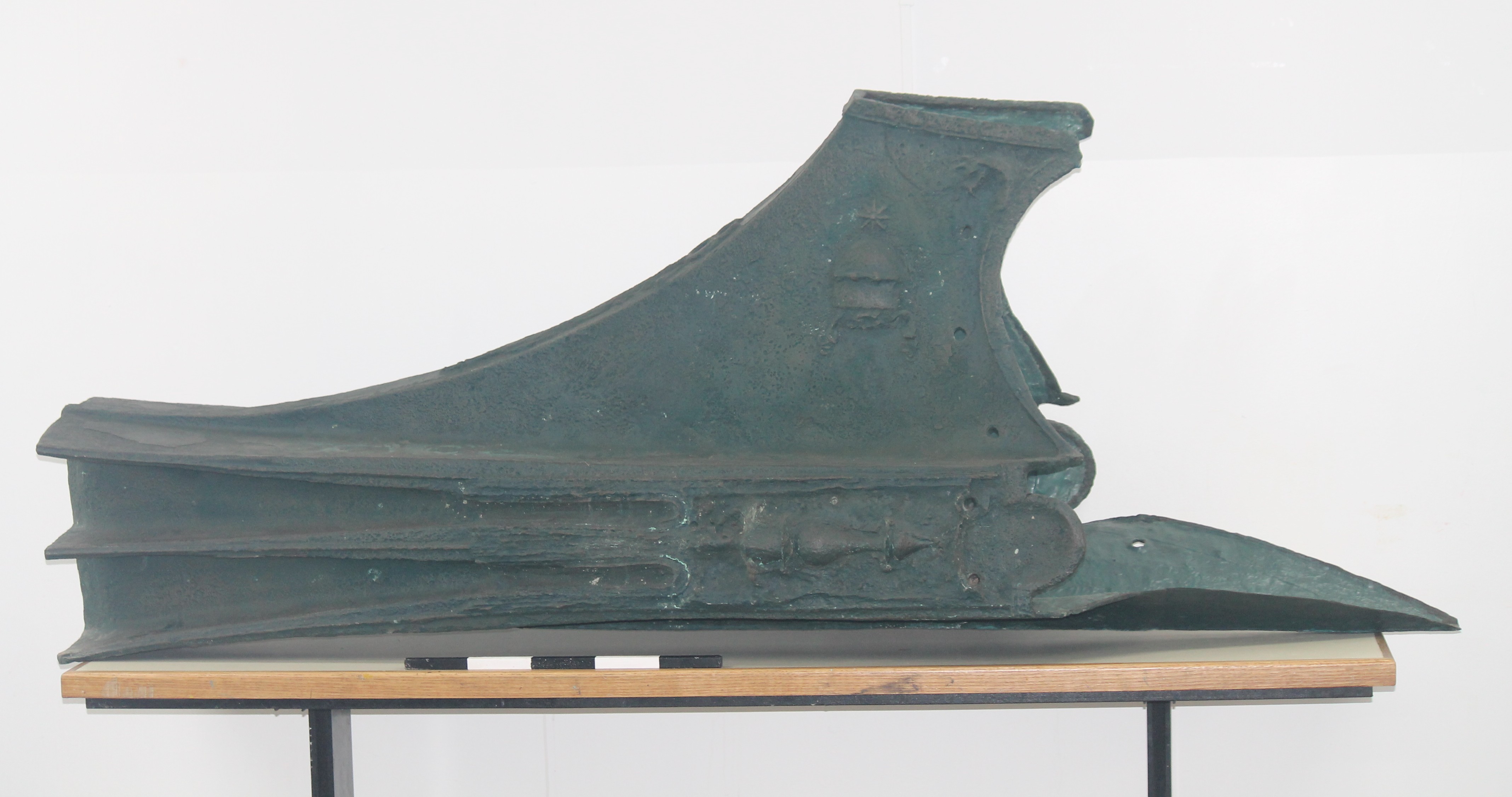
- 1:1 fiberglass replica of the Athlit Ram
- Archived concretion fragments
- Freescan Combo portable handheld metrology-grade 3D laser scanner
- Shining 3D
- FreeScan software
- Archaeological artifact reconstruction specialist
- Workstation for digital processing
 #
#
Procedure
- Preparation of the Replica
- Position the 1:1 fiberglass replica in a stable working environment.
- Inspect the replica surface to confirm preservation of the ram morphology following concretion removal.
#
2. Physical Reconstruction of Concretion Distribution
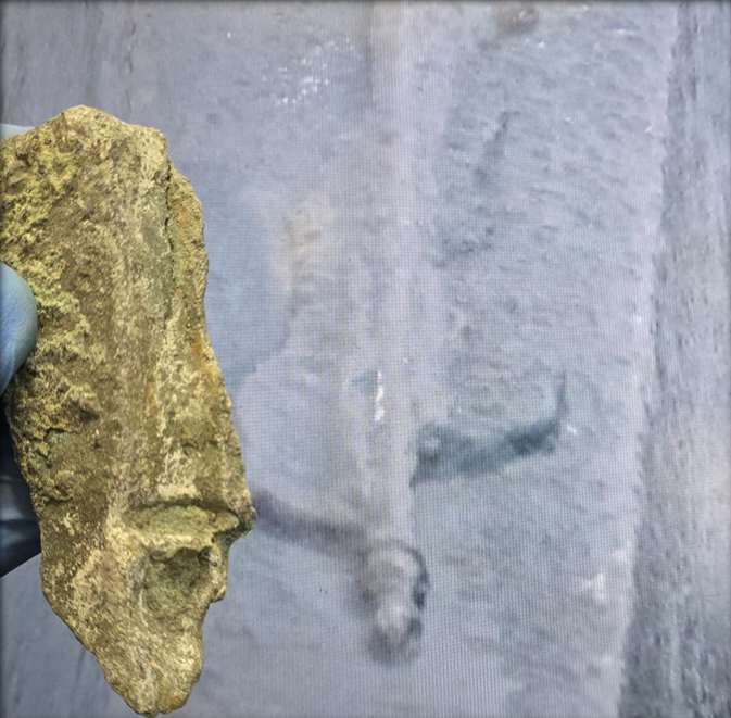
- Collect and organize all archived concretion fragments.
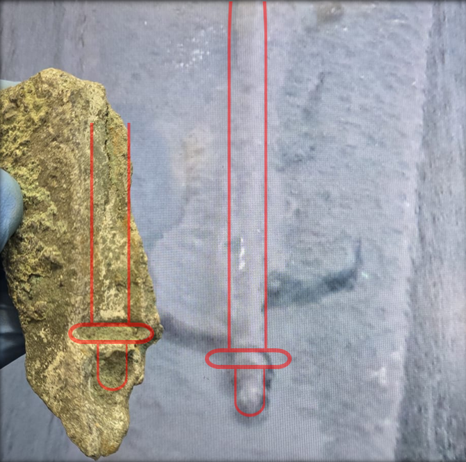
- Fragment placement should be guided by the “negative” created when removed.
-
Temporarily place fragments onto the replica surface according to their presumed original positions.
-
Adjust fragment positions iteratively until stable spatial correspondence is achieved.
#
3. 3D Digitization
-
Scan the reconstructed replica using the Freescan Combo handheld laser scanner.
- Perform scanning in infrared mode.
- Infrared mode is suitable for large textured surfaces.
- Surface markers are not required.
- Maintain a working accuracy of 0.5 mm during acquisition.
- Manufacturer instrument specification: 0.02 mm accuracy.
#
4. Digital Processing
- Import scan data into FreeScan software.
- Process and align scan datasets to generate a complete 3-dimensional model.
- Inspect the digital reconstruction for continuity and surface integrity.
#
5. Spatial Mapping and Visualization
- Use the final 3D model for visualization of concretion distribution.
- Map the spatial distribution of biological recruitment and associated assemblages across the ram surface.
- Export models and figures for further archaeological and ecological analyses.
#
6. Data
Following spatial reconstruction and mapping, fragment-associated information should be systematically organized in a table format for future analytical integration.
| Location | Live cover (Y/N) | Width | Length | Name | Date |
|---|---|---|---|---|---|
#
Notes
- Fragment placement is interpretive and based on morphological correspondence.
- Reconstruction should prioritize physical fit consistency over complete surface coverage.
- Marker-free infrared scanning reduces interference with fragile or irregular fragment surfaces.
#
Related References
Archaeological Fragment Reconstruction
-
Computational techniques for virtual reconstruction of archaeological artifacts
-
Reassembling 3D Thin Fragments of Unknown Geometry in Cultural Heritage
#